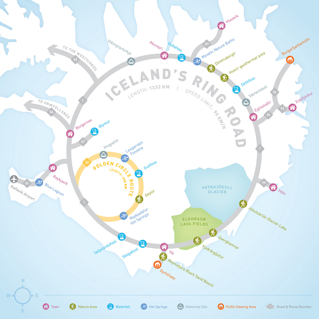
Iceland Ring Road Map
INFOGRAPHIC | CARTOGRAPHY
I decided to create a map of Iceland's Ring Road, the main tourist route across the island. I went to Iceland in the summer of 2017, and did a ton of planning to figure out what to see and what to do. The road loops and zigs and zags around the island, but is in effect a continuous loop. I wanted to create something that would be useful for a first time tourist, the kind of map I would have wanted for my trip.
I took inspiration from metro system maps, in which they sometimes distort the geographic distance between stations in order to show the overall topology of the system itself. I found the experience of driving along the ring road to be analogous to a metro system: it's a series of stops along a continuous route. And it's called the ring road, so why not just make it a ring?
I kept relative position and direction as much as possible (Vik is on the southern coast, Akureyri the north, and Reykjavik to the west), but distorted the shape of the island to conform to a perfect ring route shape. This proved to be a very tricky process, and required a lot of trial and error. But once I got it, I was surprised at how legible and recognizable the shape of Iceland still was.
Other Projects:
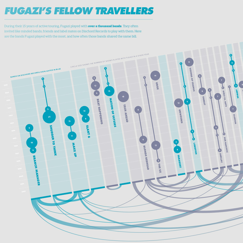
Visualizing the History of FugaziData Visualization
COVID-19 Testing Trends TrackerData Visualization
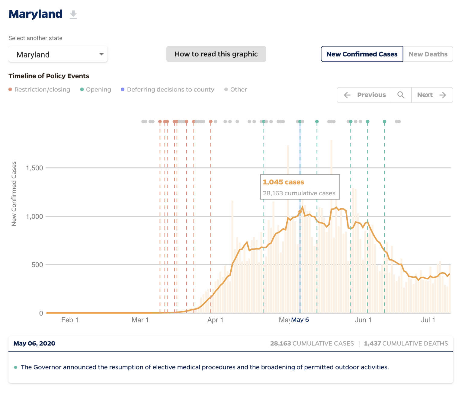
Timeline of COVID Policies in the U.S.Data Visualization
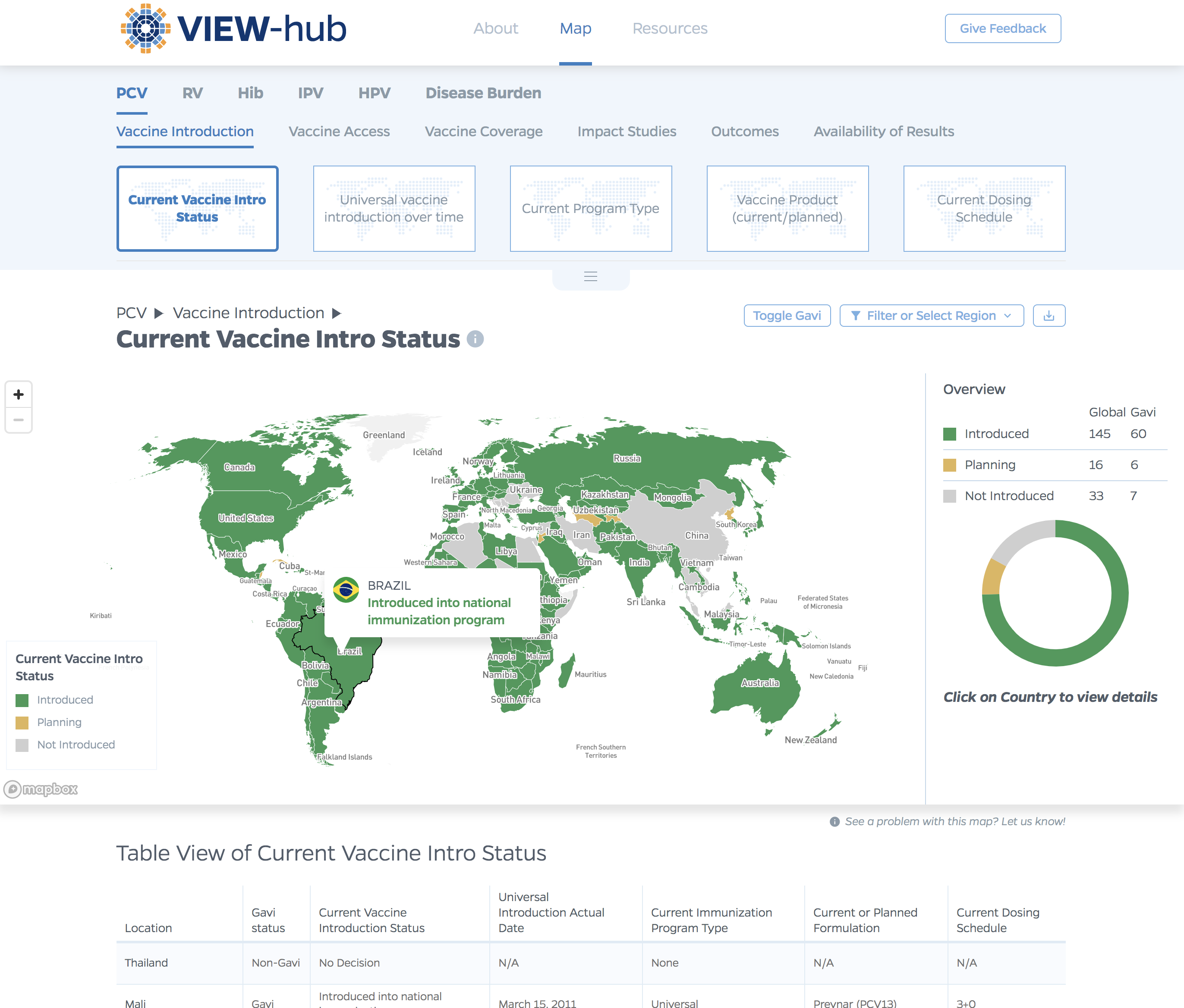
VIEW-hub website designUI/UX Design & Data Visualization
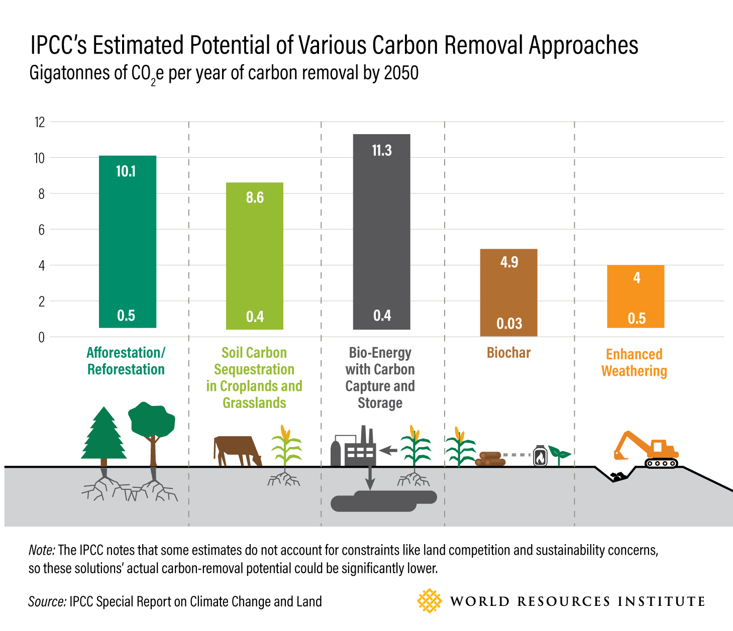
Transforming Food Systems Under Climate ChangeData Visualization & Report Design
Towards a More Equal CityData Visualization
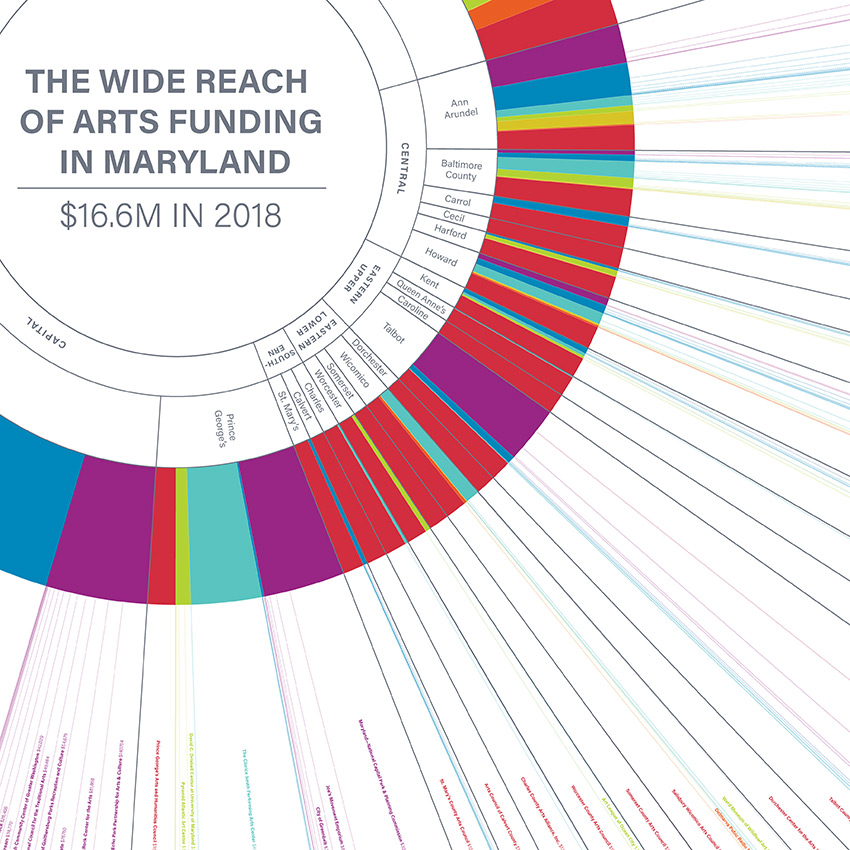
Wide Reach of Arts Funding in MarylandData Visualization
Creating a Sustainable Food FutureData Visualization & Report Design
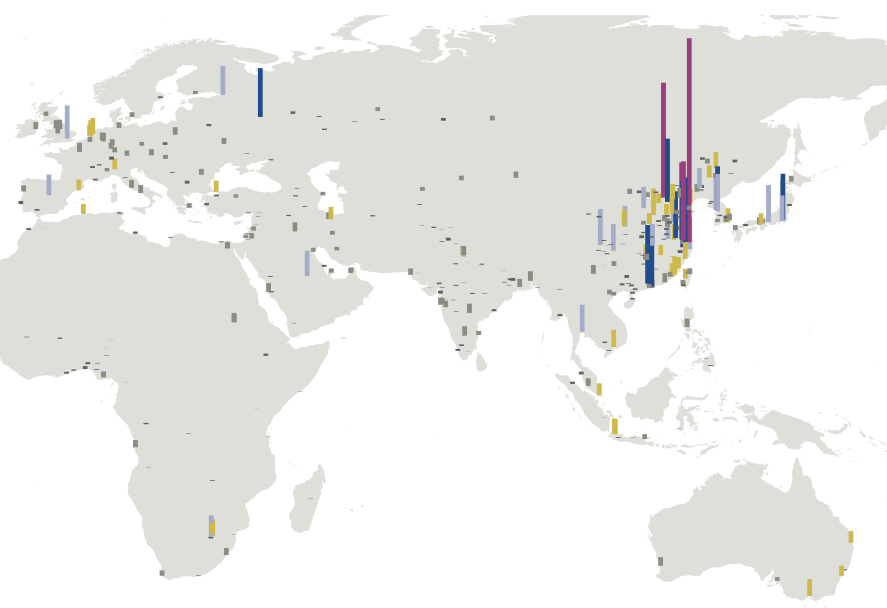
Global Commission on AdaptationMap & Infographic Design
Logo & Branding projectsLogo design
Sensible Gun Laws NowInteractive
Stories to WatchPresentation Design
Globetrotting History of MetalData Visualization
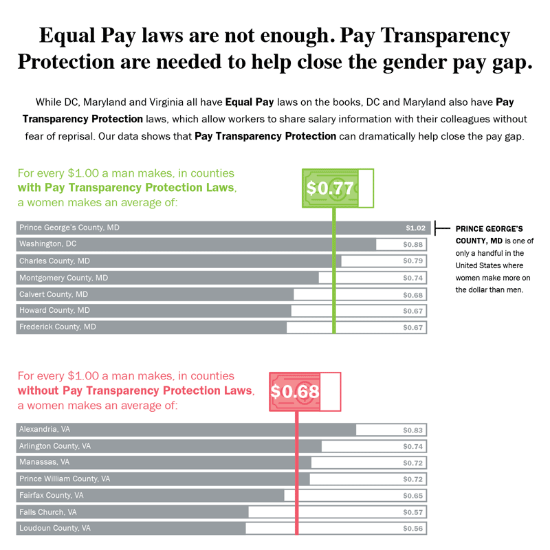
Equal Pay Laws are Not EnoughData Visualization

How to Record Your BandInfographic
WRI Blog graphicsCharts & graphs
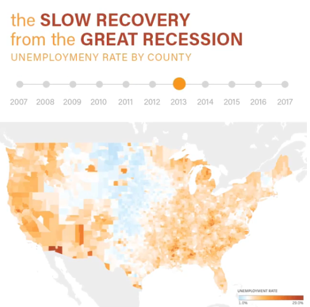
The Slow Recovery from the Great RecessionInteractive
The Race to the MoonInfographic
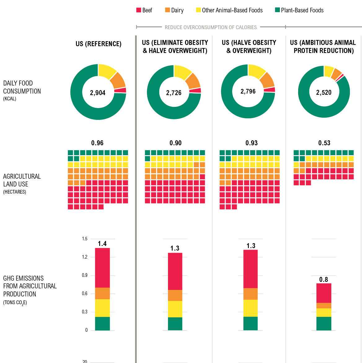
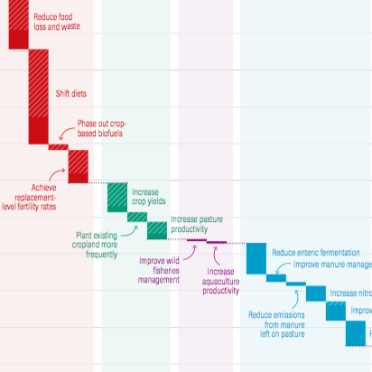
Shifting DietsData visualization
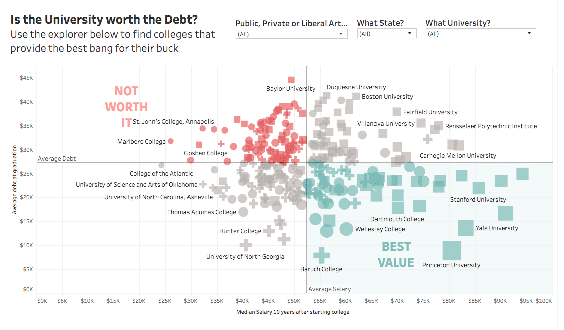
Is the University Worth the Debt?Interactive
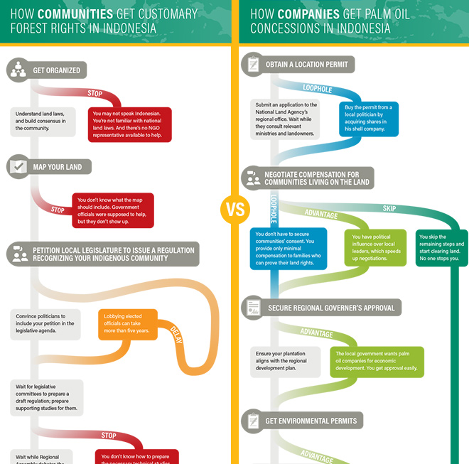
Scramble for Land RightsInfographic

Show FlyersConcert posters
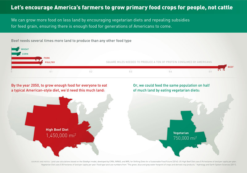
Land for Plants, not CattleInfographic
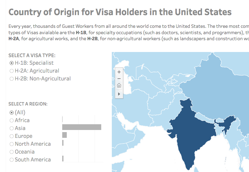
Visa Holders DashboardsInteractive
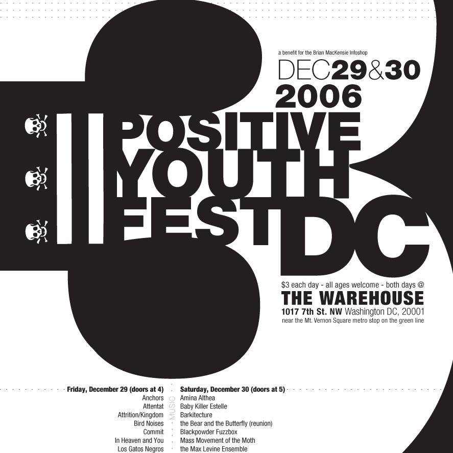
Positive Youth FestConcert Poster
Iceland Ring Road MapInfographic
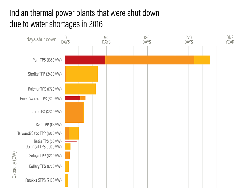
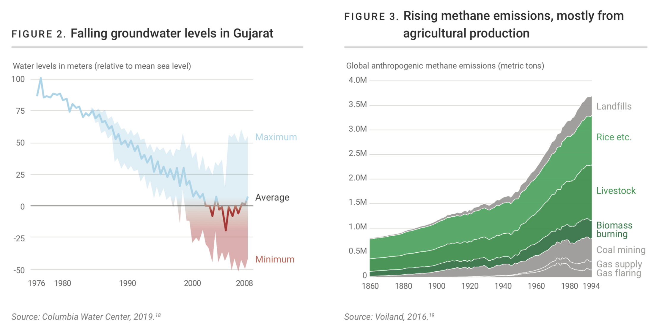
Droughts & BlackoutsData Visualization
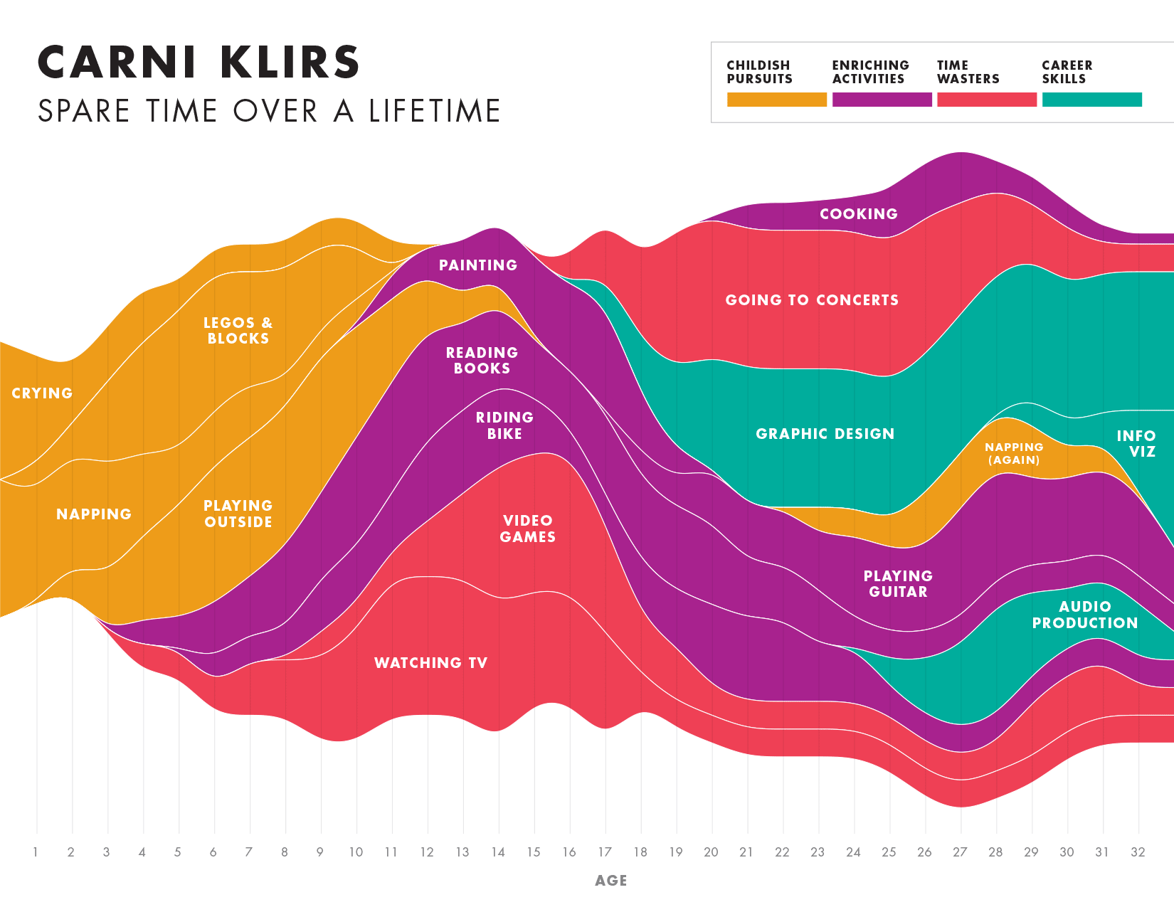
Spare Time over a LifetimeInfographic
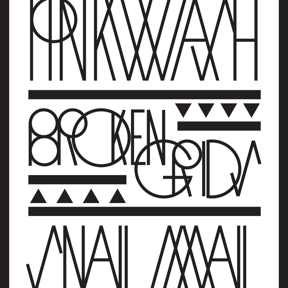
Pinkwash posterConcert Poster
Please be in touch: carni.klirs@gmail.com. Follow me on instagram or twitter.