World Resources Report: Towards a More Equal City
INTERACTIVE / DATA VISUALIZATION
A series of publications as part of WRI's flagship World Resources Report, This series of research papers and case studies examines whether providing equitable access to core urban services and infrastructure, like housing, water, sanitation, energy, and transportation, leads to more economically productive and environmentally sustainable cities. In addition to being the lead designer on most of the papers, I created interactive graphics for the blog posts accompanying the launch of each paper. Below are a collection of visuals from each paper.
Powering Cities in the Global South
Millions of residents in some of the fastest growing cities in the world don’t have access to clean, reliable energy, and the challenge of reaching them is not getting easier. This paper highlights three solutions in which the city itself can play a key implementing role: accelerating the shift to cleaner cooking; scaling up distributed renewable energy within cities; and increasing energy efficiency of buildings and appliances. The interactive graphic below uses a voiceover and auto-advancing slides to explains where the strategy of electrification (replacing fossil fuel-powered vehicles, stoves, furnaces with electric alternatives) makes the most sense to pursue. Not all cities are equally suitable for electrification. In some cases, electrification is impractical or can actually increase greenhouse gas emissions.
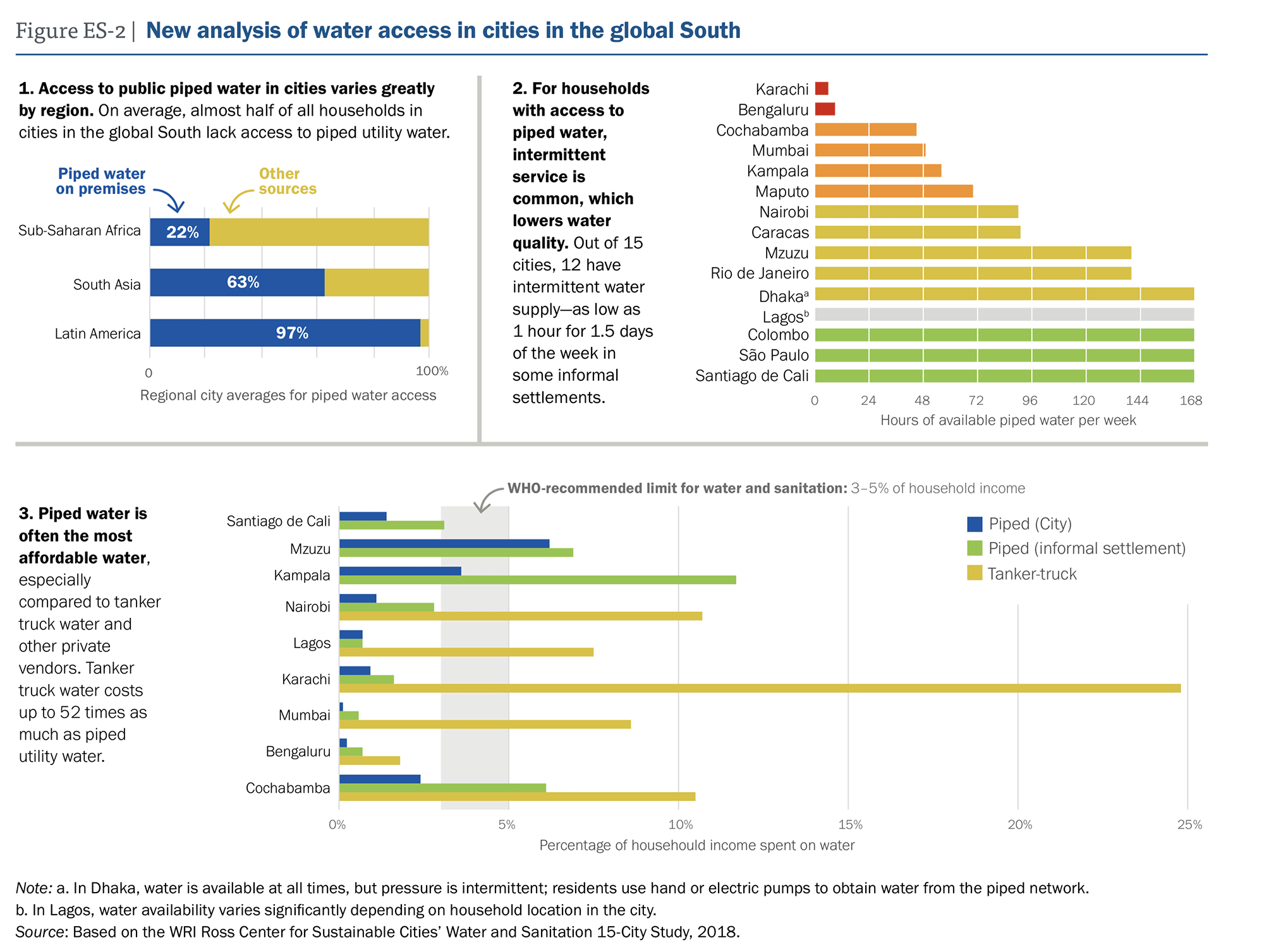
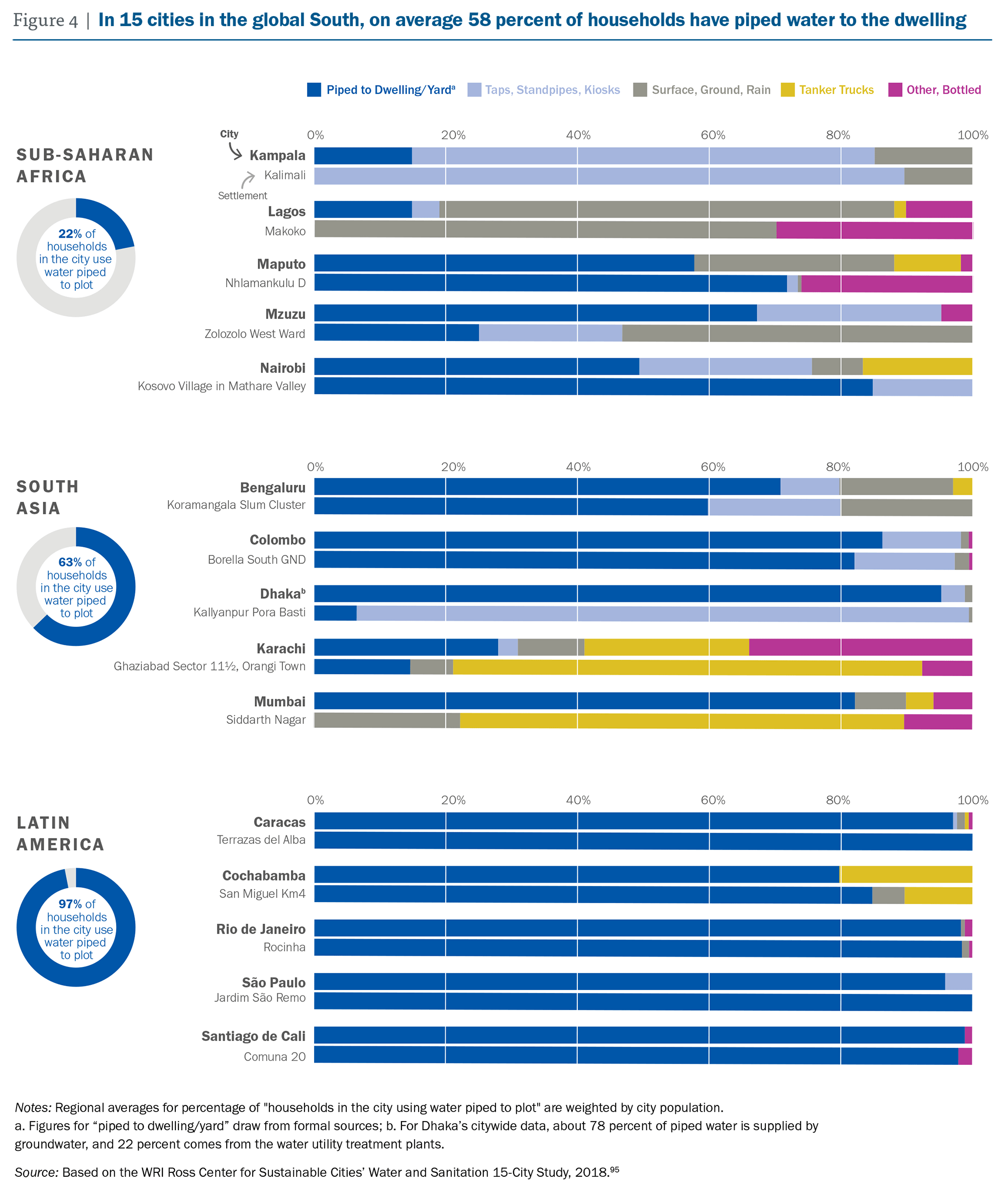
Unaffordable and Undrinkable: Rethinking Urban Water Access in the Global South
Widely used global data underestimate the urban water crisis, which contributes to ineffective planning and management of urban water provision. New analysis of urban water access in 15 cities in the global South shows that piped utility water is the least expensive water service for most households, yet almost half of all households lack access.
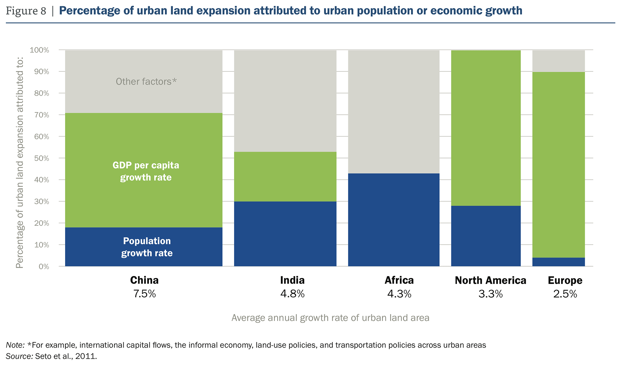
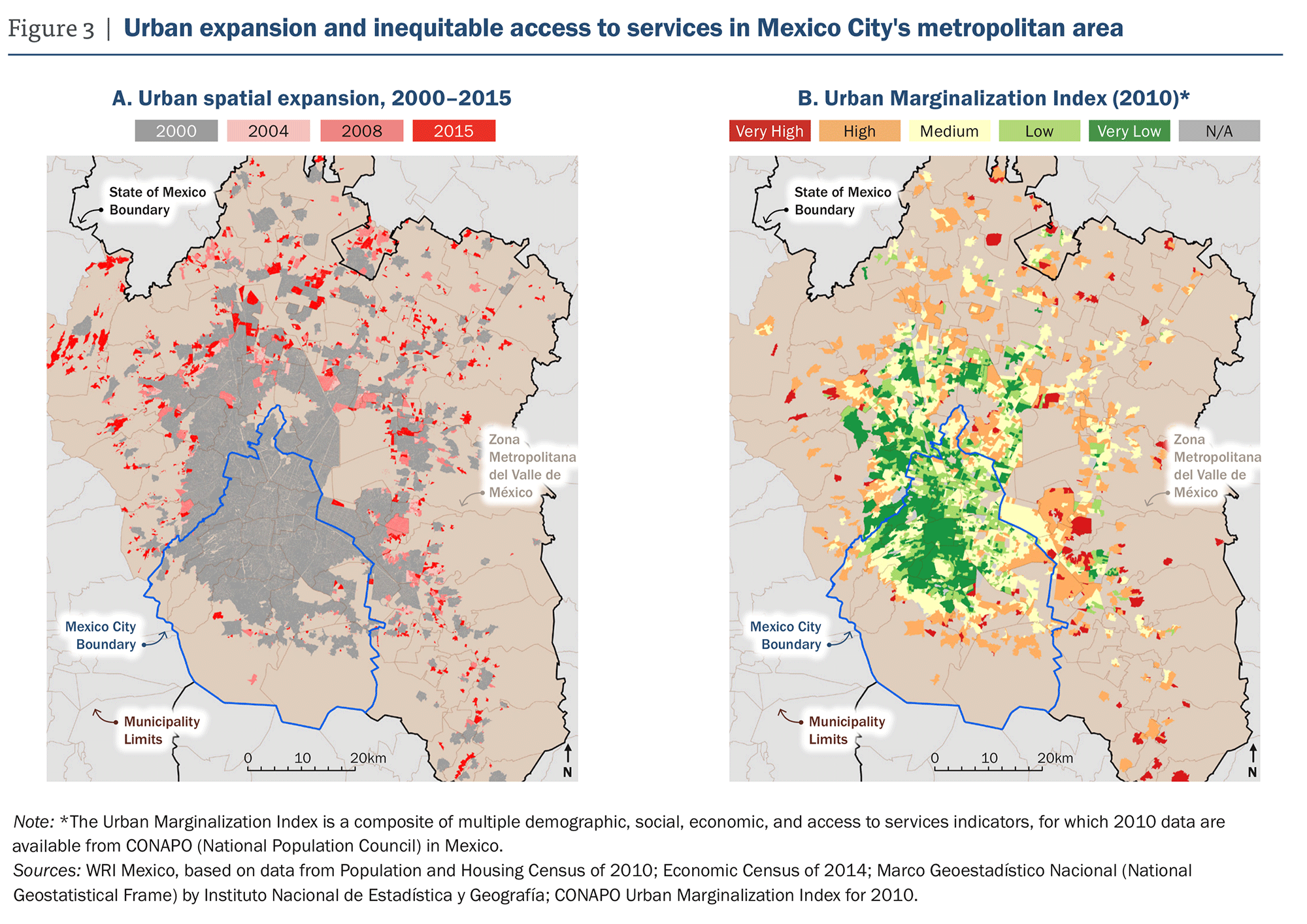
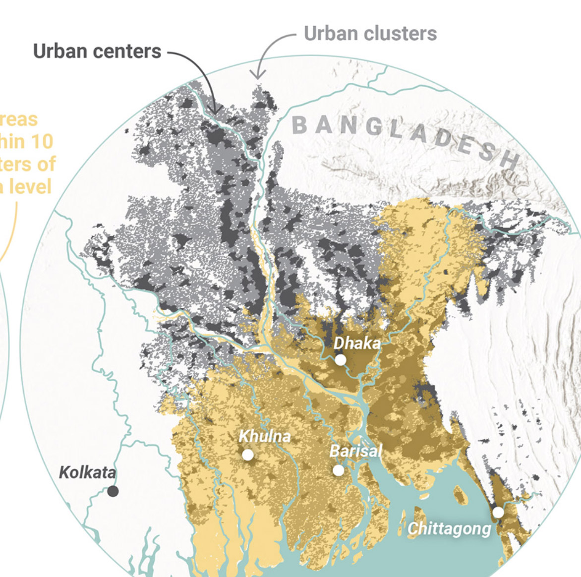
Upward and Outward Growth:
Managing Urban Expansion for More Equitable Cities in the Global South
This paper uses novel geospatial analyses techniques to determine which cities are growing unsustainably, be seperately looking at an outward (horizontal), and upward (vertical) expansion of the cities footprint. New analysis of the upward and outward growth of 499 cities over time confirms that the challenges of rapid outward expansion are greatest in lower-income cities that have weak planning and land governance and less mature financial markets.
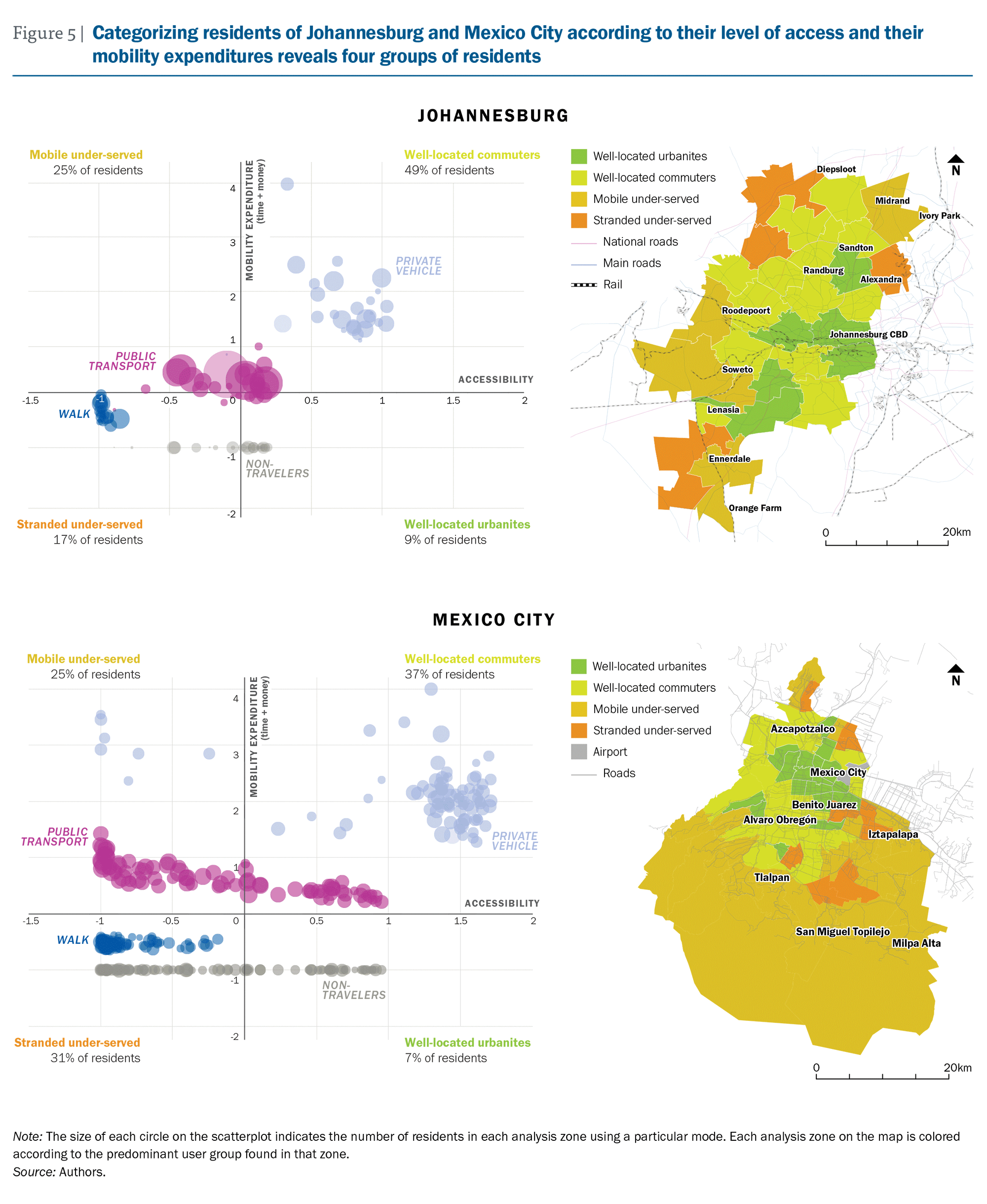
From Mobility to Access for All
This paper focused on transport and access to core city services. It uses a framework of mapping cost (time + money) vs accessibility to divide cities into four categories: 1) Stranded under-served, 2) Mobile under-served, 3) Well-located commuters, and 4) Well-located urbanites. This framework helps cities better understand where there may be gaps in access to jobs and services.
Other Projects:
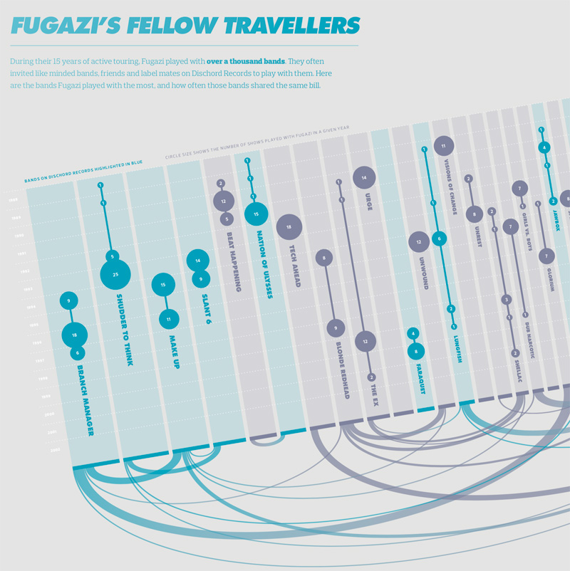
Visualizing the History of FugaziData Visualization
COVID-19 Testing Trends TrackerData Visualization
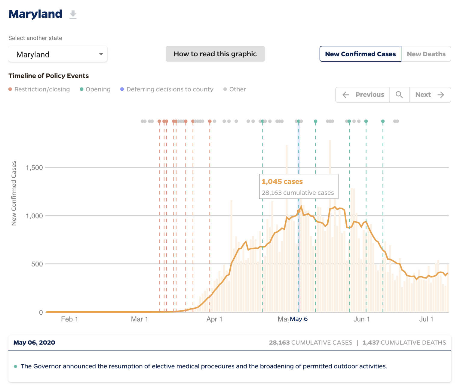
Timeline of COVID Policies in the U.S.Data Visualization
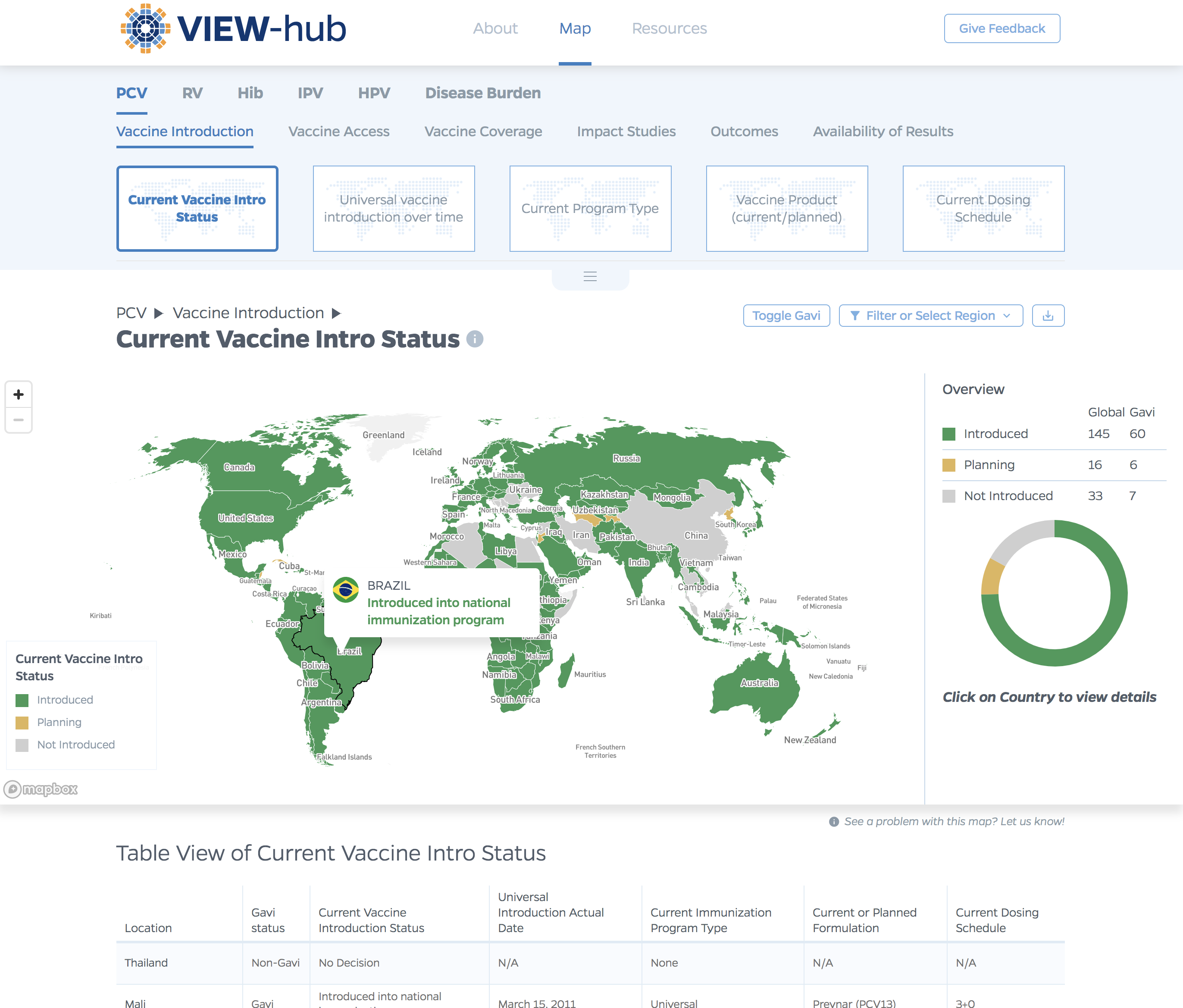
VIEW-hub website designUI/UX Design & Data Visualization
Transforming Food Systems Under Climate ChangeData Visualization & Report Design
Towards a More Equal CityData Visualization
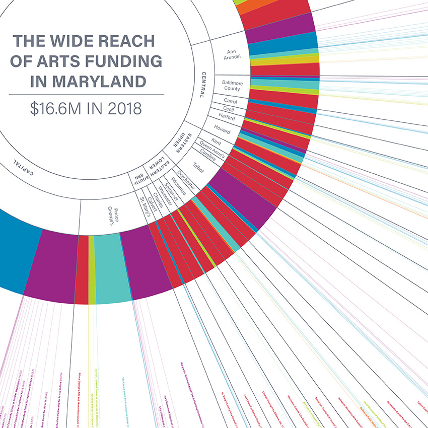
Wide Reach of Arts Funding in MarylandData Visualization
Creating a Sustainable Food FutureData Visualization & Report Design
Global Commission on AdaptationMap & Infographic Design
Logo & Branding projectsLogo design
Sensible Gun Laws NowInteractive
Stories to WatchPresentation Design
Globetrotting History of MetalData Visualization
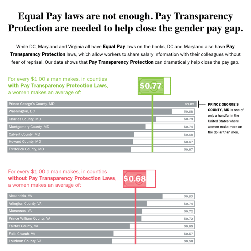
Equal Pay Laws are Not EnoughData Visualization

How to Record Your BandInfographic
WRI Blog graphicsCharts & graphs
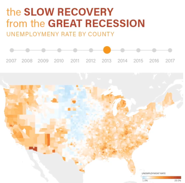
The Slow Recovery from the Great RecessionInteractive
The Race to the MoonInfographic
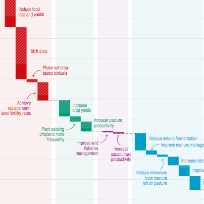
Shifting DietsData visualization
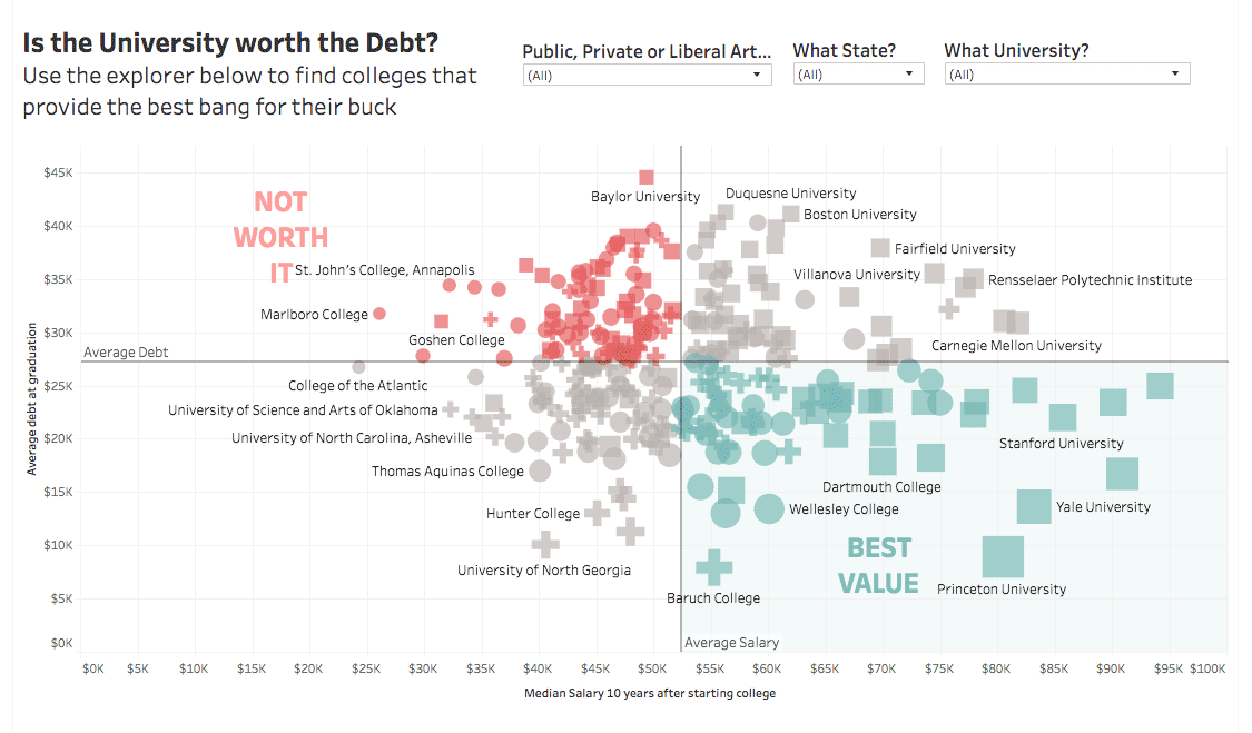
Is the University Worth the Debt?Interactive
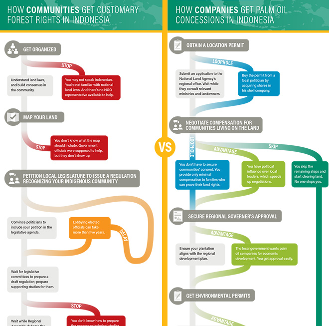
Scramble for Land RightsInfographic

Show FlyersConcert posters
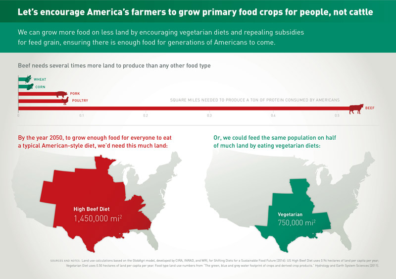
Land for Plants, not CattleInfographic
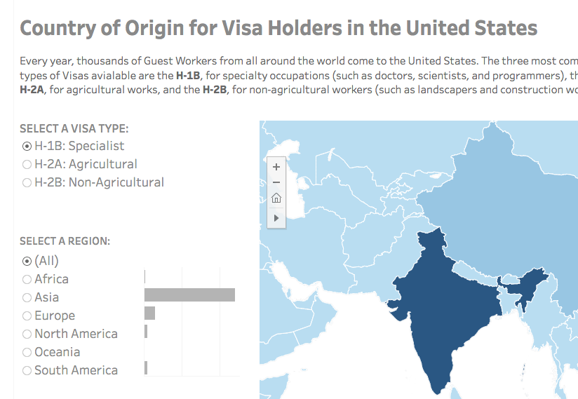
Visa Holders DashboardsInteractive

Positive Youth FestConcert Poster
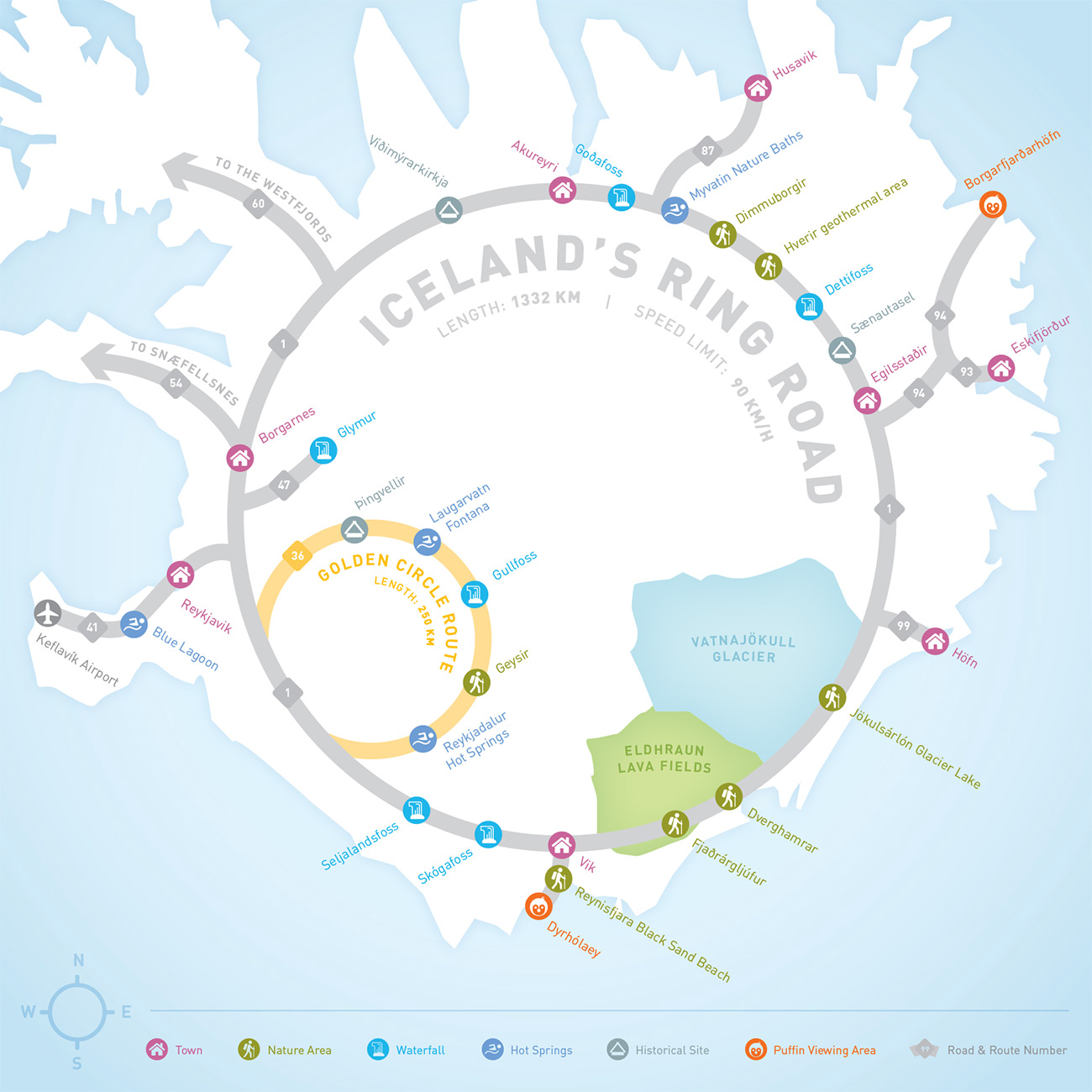
Iceland Ring Road MapInfographic
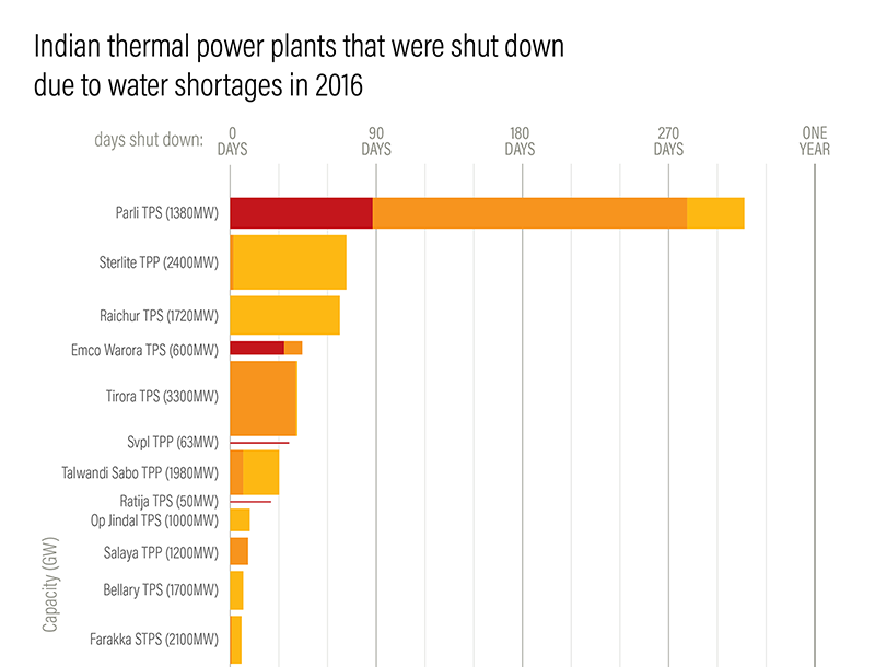
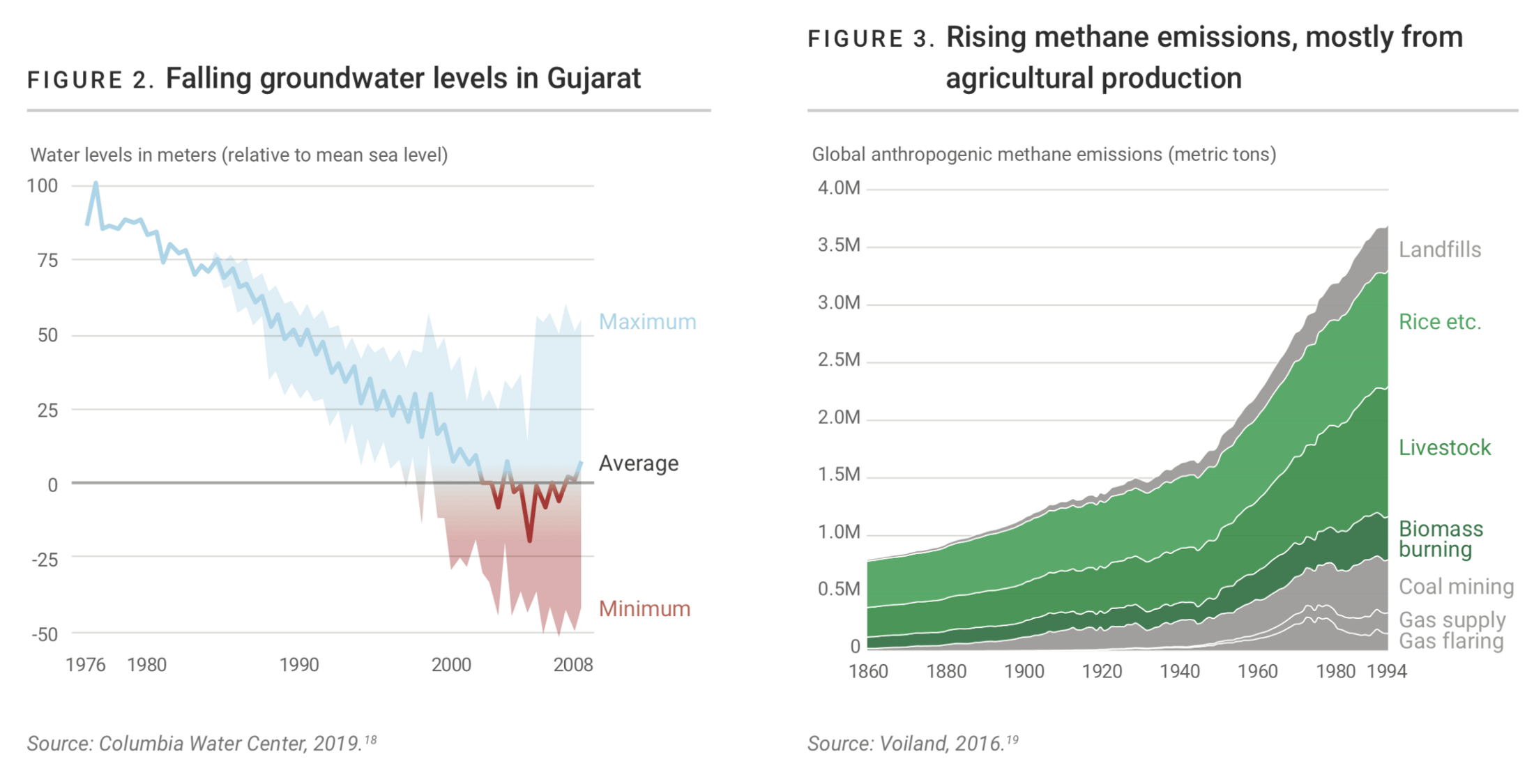
Droughts & BlackoutsData Visualization
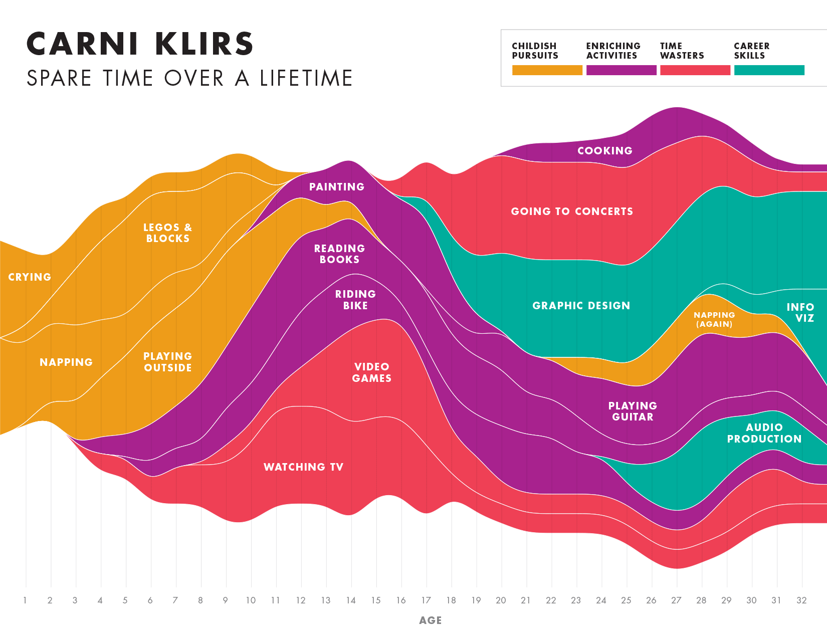
Spare Time over a LifetimeInfographic

Pinkwash posterConcert Poster
Please be in touch: carni.klirs@gmail.com. Follow me on instagram or twitter.